Wednesday 23 / September / 2026
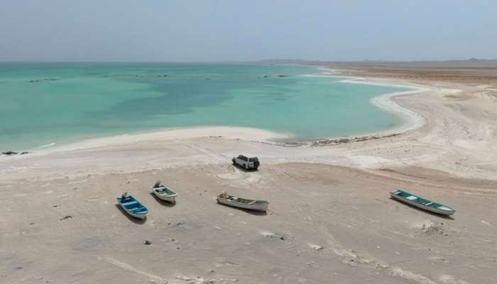
Masirah— The Environment Authority, represented by the Environment Center in the Wilayat of Masirah, South A’Sharqiyah Governorate, has commenced field survey work within the framework of two indicators of the Authority’s operational targets for 2026.
These indicators relate to the number of field surveys of coastal marine ecosystems and the rate of safety of water connectivity between lagoons (khawrs) and the sea, aiming to evaluate the environmental condition of coasts and coastal wetlands and enhance the national biodiversity database.
The survey work also aims to provide accurate field data on beach characteristics, natural components, and environmental pressures they may be exposed to, thereby contributing to assessing their condition and identifying sites of environmental importance and priority in protection and management efforts.
In its first aspect, the field survey work involves conducting longitudinal beach surveys by dividing them into segments each four kilometers in length, and documenting the beach's nature and the proportions of its components. This is alongside monitoring coastal erosion indicators and recording biological and environmental observations at the sites, including mangroves and coastal plants, tracks and nesting signs of sea turtles, invertebrates, and birds, in addition to inventorying the types of waste present on the beaches.
In the second aspect, the survey work covers coastal wetlands, with a focus on evaluating the safety of water connectivity between lagoons and the sea by measuring several physical water indicators during high tide. This is alongside conducting hydrological measurements of the lagoons, including the width and depth of their openings, the extent of tidal movement impact, and the percentage of tide water reaching inside the lagoon, in addition to documenting biodiversity components at the sites covered by the survey work.
Ghasi Hamad Al Farsi, Supervisor of the Environmental Control Unit at the Environment Authority Center in the Wilayat of Masirah, said that these surveys represent one of the important scientific foundations for assessing the environmental condition of coastal ecosystems and providing field information that contributes to identifying areas eligible for protection and guiding environmental management work based on actual data and results.
He added that the field team utilized sensing and aerial documentation technologies using an unmanned aerial vehicle (drone) to document the sites from above, monitor the extent of lagoons and their openings, mudflat areas, and the spread of mangroves, alongside defining beach erosion lines. He explained that aerial photos constitute a visual reference that can be relied upon for future comparisons and for tracking changes that may occur at the sites during coming seasons.
He noted that aerial photography operations are carried out according to controls and safe altitudes that take into account the nature of the sites and the sensitivity of wildlife, thereby minimizing the potential for disturbing birds and creatures present in coastal areas.
He stated that the Environment Center in the Wilayat of Masirah has introduced electronic field forms allowing teams to record data directly from the devices used in the survey, with the ability to operate without requiring a network connection, alongside automatically recording the geographic coordinates of the sites.
He pointed out that this mechanism contributes to accelerating the field data collection process and transitioning it to analysis phases, while reducing the need for manual data re-entry. This limits the chances of error, saves time and effort, and enhances the accuracy of data used in preparing environmental reports and studies.
The survey work comes as part of the Environment Authority's efforts aimed at enhancing environmental monitoring of coastal ecosystems and building and updating an integrated national database on their components, characteristics, and changes occurring in them. This supports planning and decision-making processes and contributes to setting priorities for protection and sustainable management of natural resources and biodiversity in South A’Sharqiyah Governorate.